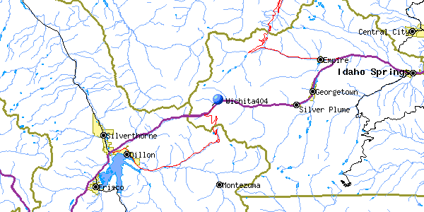
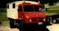
Wichita State Football Team's Martin 4-0-4
| Name | Wichita State 404 |
| CAP data | 394141N 1055255W 02 Oct 70,M404,<described below> |
| GPS coords | 39 41 35.7N 105 52 54.8Wby GPS (0.1 mile error) |
| GPS decimal | 39.69325 105.88190 |
| UTM | |
| Datum used | NAD 27 |
| County | Clear Creek County |
2 October 1970
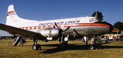 |
| Martin 404 picture courtesy of Geoff Sobering per his
website
|
(Click on pictures to get enlarged image)
 |
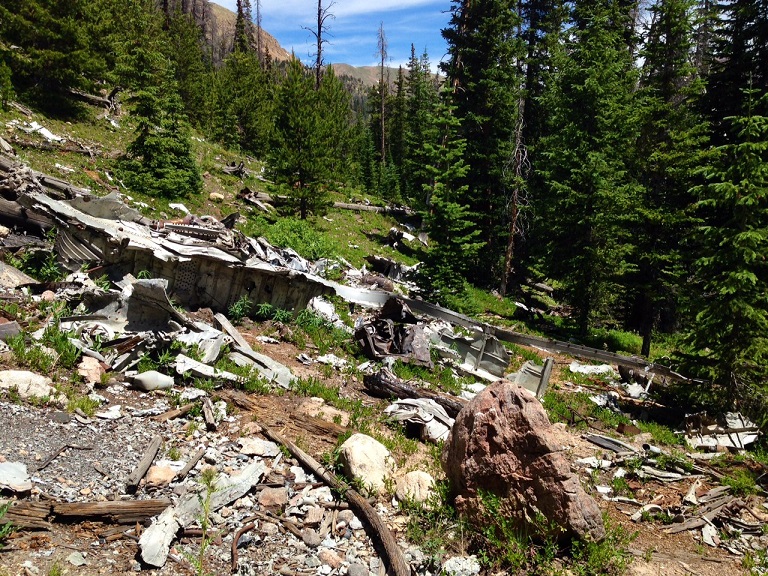
| Crash site looking east(39d 41' 35.7" N 105d 52' 54.8"W) |
CAP wording: 4 miles west of Bakerville, 1200 ft NW I-70, just below mesa at 11,100' level, from where Dry Creek crosses I-70, 2600 ft on 242 degrees mag. bearing. Burned. Wichita State Football Team. 30 fatalities, 10 survivors. Pilot: D. Crocker. Copilot: R. Skipper.
The wreck cause: (I've seen a report on this but can't lay my hands on it at the moment.) Controlled flight into terrain. Flight was following Clear Creek Canyon and could not climb quickly enough to clear terrain.
A link which briefly explains the wreck cause.
The (nearly) complete NTSB accident investigation report kindly provided by Randy Holder.
Casualties: 30 fatalities, 10 survivors (per CAP)
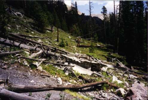
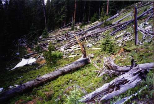
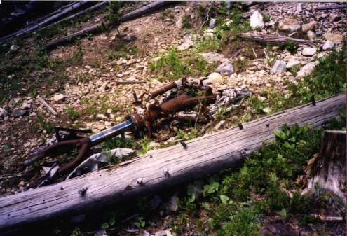
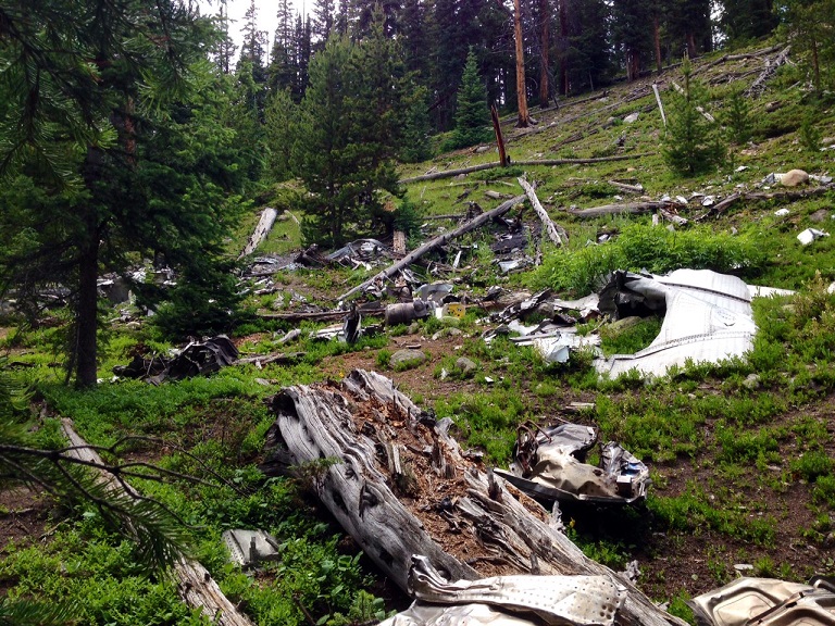
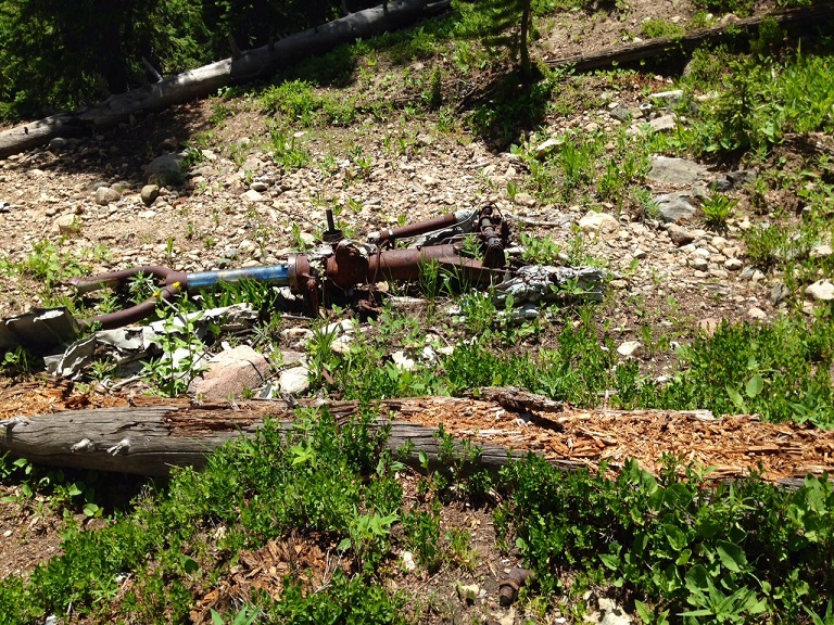
Site Description:. In trees slightly below timberline. There is a rough road to the site which was used to remove much of the wreckage. What remains are landing gear legs, the aircraft toilet, an oil cooler, a 3' section of wing, and misc. twisted pieces of aluminum sheeting , tubing , fittings and wiring. The site is on a moderately steep slope and is not extensive in area.
 |
 |
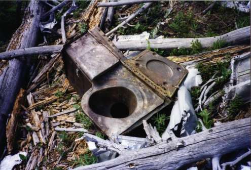 |
| Site looking west | Nose gear | Aircraft toilet |
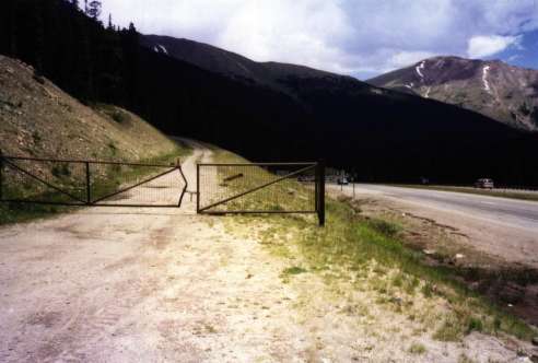
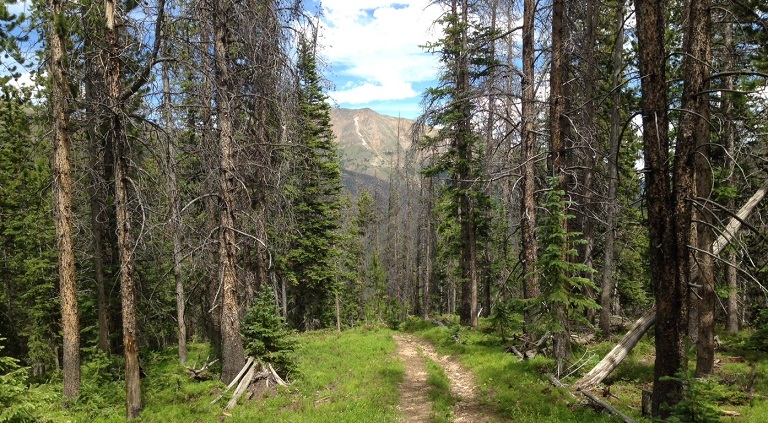
Best route : Travel west up I-70. Take the Loveland Pass/US 6 exit. While you are on the exit ramp you will notice there is a dirt road paralleling I-70 and your exit ramp. About 200 yards down the Loveland Pass ramp the dirt road intersects with the ramp. Turn hard right and take the dirt road back parallel to I-70 to the east. Park at the locked gate. (39d 41' 31.7"N 105d 52' 42.6"W) Hike up the wide, wide road which tends east then climbs up along Dry Gulch creek to what appears to be a man-made dam area and an equipment compound. West of the equipment compound a very rough 4WD road takes off to the west (39d 41' 51.8"N 105d 52' 38.6"W) and goes directly up a steep hill. This road goes to the wreck. There are no side roads along it. It will climb up the hill for perhaps 800' elevation gain then it will turn level in a marshy area. Continue along the road. It will then descend briefly then take a 90 degree turn sharply down what looks like a creek bed. This is not a creekbed - it is erosion of the road which was cut straight down the hill to the western edge of the wrecksite. Site coordinates are: 39d 41' 35.7" N 105d 52' 54.8"W If you prefer not to follow the road completely, you can leave the road just west of the marshy area and bushwhack down the hill angling slightly to the right. The CAP coordinates are ON the road at the level spot. The wrecksite is 0.1mi angled downhill to the west from there.
 |
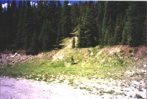 |
| locked gate. (39d 41' 31.7"N 105d 52' 42.6"W) | 4WD road (39d 41' 51.8"N 105d 52' 38.6"W) |
There is a memorial to the fatalities where Dry Creek runs under I-70 about 0.45 mi. downhill from the parking spot. There is no turnoff or exit for this memorial, only a wide sandy shoulder along I-70. There is a cross and various trinkets and flowers left by mourners at the memorial.
 |
| Roadside marker, 1/2 mi. east |
 |
 |
| Pictures courtesy Alan Gionet KCNC TV 4 Denver |
 |
 |
| Pictures courtesy Alan Gionet KCNC TV 4 Denver |
Home Moggie!
Last Modified: 8/24/2014