Stafford Creek Unknown
| Name | Stafford Creek Unknown |
| CAP data | None. |
| GPS coords | N39 29.093 W106 14.107 |
| GPS decimal | N39.48489 W106.23512 |
| UTM | 13 S 393781 4371315 |
| Datum used | NAD 83 |
| County | Summit County |
The wreck cause: Not a wreck. Not an aircraft. Probably a WWII or Korean War era Navy drop tank.
Casualties: None known or likely. Not a wreck listed by Civil Air Patrol.
Site Description: Stafford Creek drainage about 3 miles upstream of where the creek crosses under I-70. On the north side of the drainage beyond where the Stafford Creek trail crosses from the N to the S side of the creek. Altitude 11,300'
Best route to visit begins by pulling off of I-70 Eastbound just before the Stafford Creek Bridge at N39 29.093 W106 14.107. There is a 4WD road on the north side of the creek that goes about 1/3 mi into the trees. Park here. Walk the trail along the creek uphill to where the trail crosses the creek at about here- N39 29.270 W106 13.421. Don't cross the creek but keep on travelling uphill and climbing away from the creek until you reach the site. (Use your GPS as the exact spot is pretty difficult to describe as it's just a shelf with a few trees on the side of the canyon wall in an area with many other shelves.)
Trip to find the Stafford Creek Unknown.
The adventure began with an email from Brian Anderson about the end of Sept 2015 asking if I knew of a crash site about 3 miles off of I-70 south of Vail Pass. Brian had searched all the ways he knew to figure it out and had come up empty. He then asked if I could help. He sent pictures and a precise GPS location. He'd found the item while backpacking off trail in the area. I shared the puzzle with my wreckchasing friends and consulted the CAP wreck list. There was nothing that matched the location within 10 miles in the wreck list. Brian Richardson did some creative interrogation of the NTSB accident database and found DEN91LA091 which was a 1991 crash of a Stearman biplane in the vicinity but the pictures indicated structure that didn't match anything on a Stearman.
So a visit would be required to look for a part number. Airplanes have lots of part numbers marked on their parts and the part numbers usually have a prefix indicating the type of aircraft (once you have the decoder ring). I queried the usual suspects to see who would be available for a short-notice run to the mountains. I wanted to get there immediately because winter was coming quickly and this seemed like it would be a reasonably easy site to reach and resolve the puzzle.
Brian Anderson couldn't make it which was a disappointment because it's always better to have someone lead you there. Ultimately only Dave Seniw could make it.
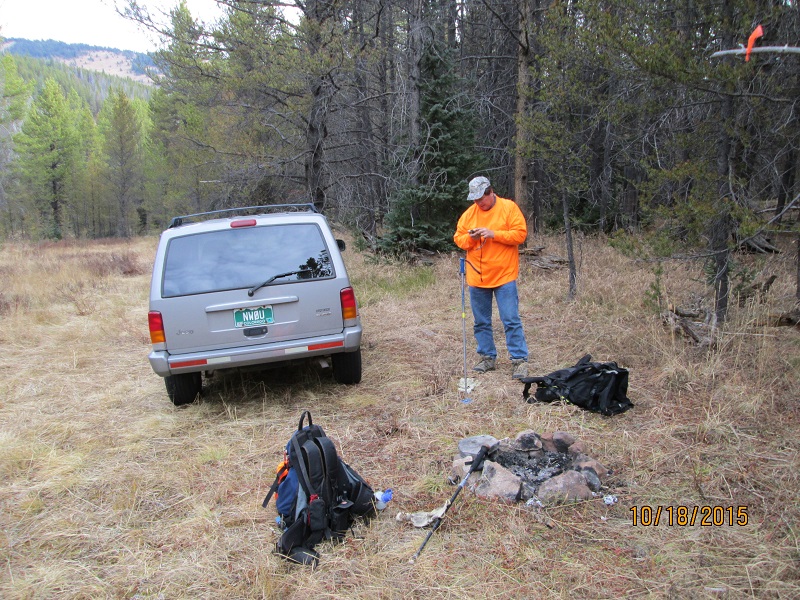
So on Oct 18 I picked Dave up in Denver and we drove West up I-70, turned around at the visitor center, drove back East down to the Stafford Creek bridge, turned off the interstate and went into the trees as far as the 4WD road was clear. Even though it was hunting season, there were no vehicles parked along here.
Both of us were wearing significant amounts of blaze orange just in case. We started hiking at 0930. The trail actually starts out as an old two-track road that appears to have been bladed somewhat even though it's not been drivable for a long time. Then it shrinks down to an easily followed single track trail. About a mile and a half up the trail the beaten trail crosses the creek. We took up a heading from there sidehilling upwards directly to the site coordinates. The final 30' or so are quite steep but at 1130 I dropped my pack by the debris. Dave caught up a few minutes later. We drank water and had some lunch before exploring.
|
|
| Parked and Blaze Orange |
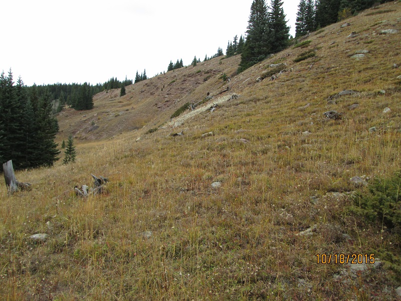 |
| Final pitch to the site |
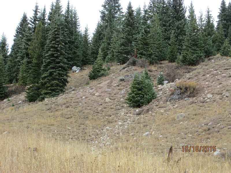 |
| Debris from afar |
So Dave and I looked at the big chunk of debris.
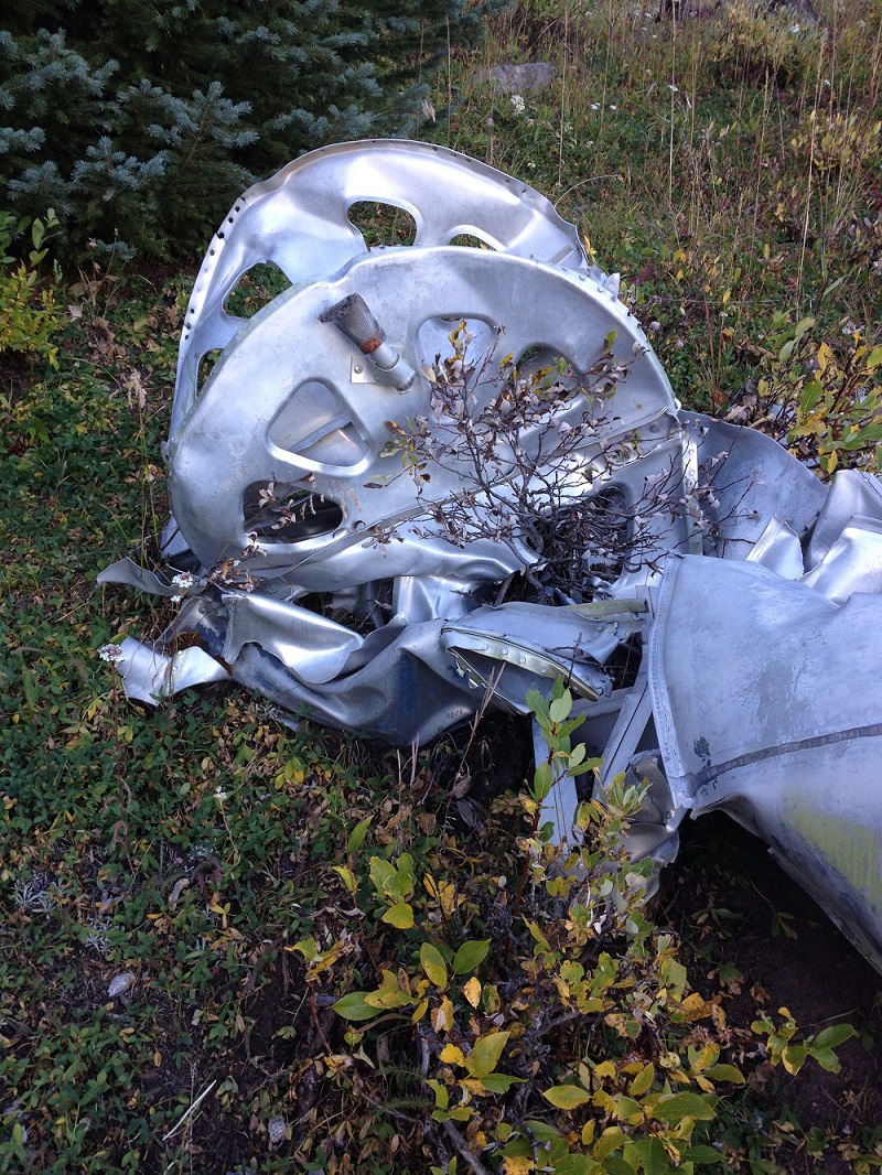 |
| Bulkhead with pipe (picture courtesy of Brian Anderson) |
Then turned it over and looked some more.
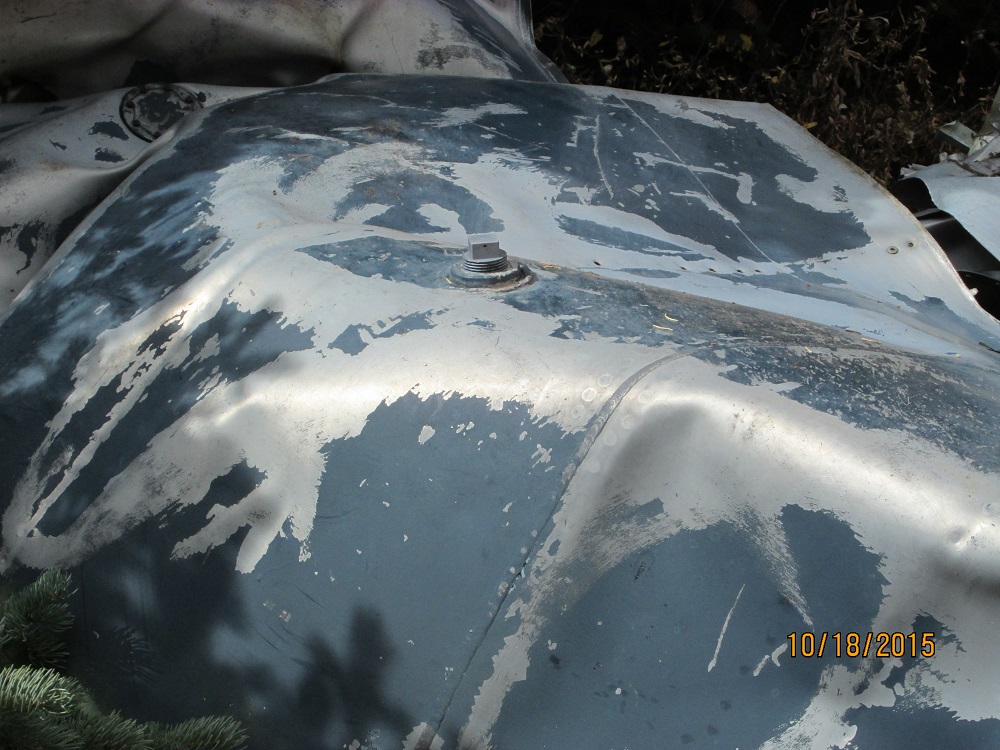 |
| Threaded plug |
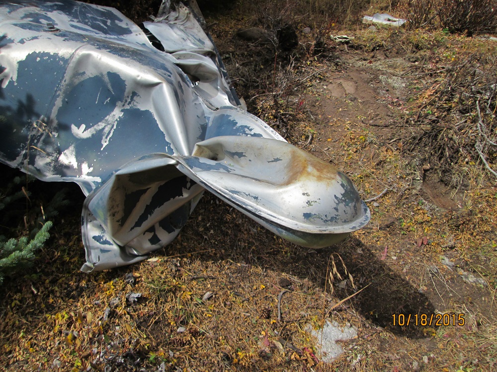 |
| Rounded projection |
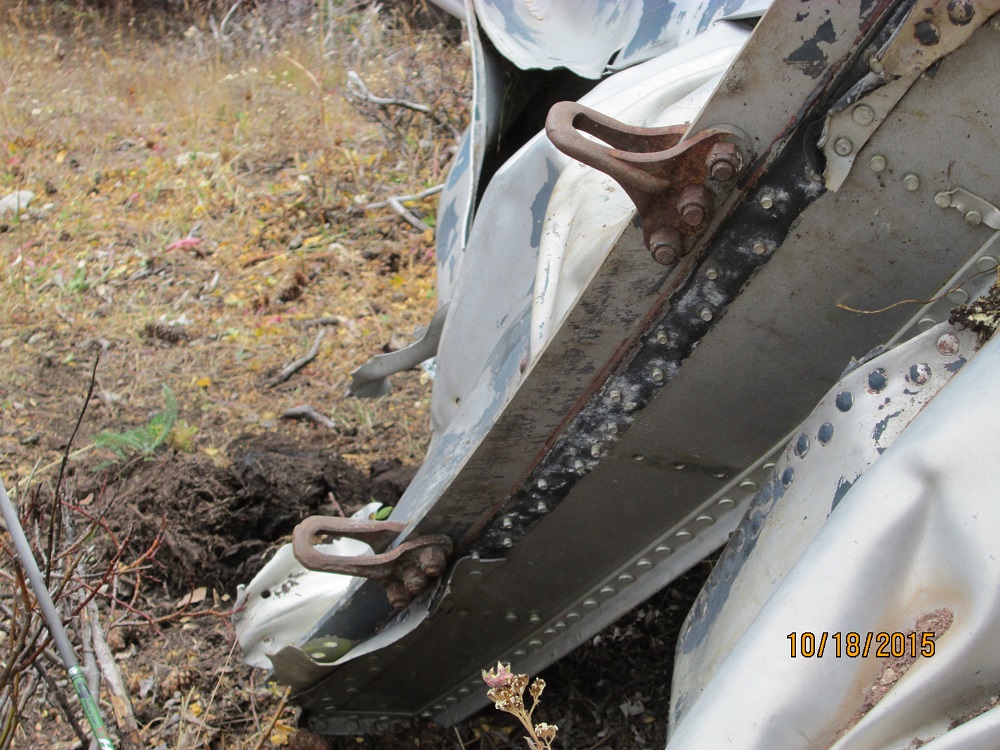 |
| Steel shackles on a thick aluminum keel piece? |
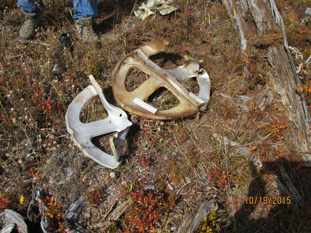 |
| Other bulkheads around (found about 2 more) |
We carefully examined all the pieces looking for part number stamps but found none. An inspection stamp was found but we've never correlated it to anything.
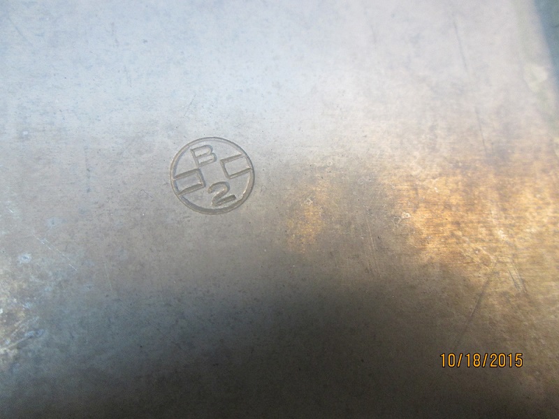 |
| Aluminum inspection stamp on a bulkhead |
After returning home and thinking about it and considering the lack of wires, control cables, other debris, lack of tracks from debris recovery vehicles (if any), the diameter of the bulkheads- the final conclusion was made- AIRCRAFT DROP TANK (external fuel tank). The picture from Brian with the pipe on the bulkhead is actually upside down from how it would be on the airplane. The mesh booty on the end of the pipe would be a strainer to prevent sucking up debris into the fuel system. More than likely it had fuel in it when dropped so that it ruptured and deformed rather than just getting dented. The dark blue color suggests possible Navy color scheme. Beyond this - we don't know and would only be speculationg. If you know who dropped this here - I'd like to hear about it!
Note that Camp Hale is about 5 miles away over the ridge to the west so military airplanes maneuvering in the area would not be too unusual. Of course other explanations are possible.
Anyway, it was a fun adventure just before the snow fell. The return to the car was about 90 minutes since it was downhill.
Of note is that both Dave and I marked the location of the parked car before we started hiking. My GPS put the position on the wrong side of the creek while Dave's put the position a few hundred yards away. Don't blindly follow your GPS. Cross-check with trail and topography.
Home Moggie!
Last Modified: 11/25/2015