Mt. Cirrus F-100
(Here is a trip report which gives some more detail on what it’s like to go look for a wreck site in a remote area.)
First Trip, First Find-
TRIP TO NEVER SUMMERS IN SEARCH OF THE CRASH SITE OF AN F-100
By: Ron Miller,
The Goal: Reach, record GPS coordinates of, and photograph the remaining wreckage of an F-100C Super Sabre fighter jet crash near Mt. Cirrus in the Never Summer range of mountains in N. Colo.
The Site: On 30 Jan. 1967, 2nd Lt. Eldon C. Hart was lost while on a routine training mission. The accident report described Lt. Hart as having gone into cloud and losing control while executing a barrel roll around the lead aircraft to bleed off overtake velocity. He did not eject and the aircraft was not found for months.
Civil Air Patrol listed the wreck at one location, Bill Boyd, whose report about the Never Summers appears in the Rocky Mtn Nat'l Park webpage, reported a slightly different location though he didn't know at the time what he was looking at.
My researcher/historian friends in Estes Park had a site report from a fellow who had visited the site in 1967.
The Plan: Make a 2 day backpack trip out of it with my buddy Thomas.
Preliminaries: Thomas couldn't go. So I packed for a solo effort (meaning that I added the weight of my 2m ham radio and a revolver and carried my one-man tent).
Friday 8/2/96-
0825 Rolling from south Ft. Collins.
1040 Turnoff from Colo. Hwy 14 at Gould onto USFS roads. (83 miles from home)
1115 After 3 miles of 4WD LO across Calamity Pass I reach Teller City ghost town site. There was a sign at the entrance warning that it would be closed to vehicle traffic and camping someday. Neither of the USFS people in the area knew anything about it.
1225 To Baker Pass trailhead up at the head of Jack Creek Wilderness boundary. Cloudy in the area, it starts raining and hailing before I shut down. 6.4 miles of 4WD LO from Teller City, 4 hrs from home.
1300 Hiking. Two people climb off an ATV at the trailhead and hike too. From Iowa, they spend 1 week per summer here. We shelter in some trees and talk as more hail blows thru. Turns out that they'd been to the wreck a few years ago. Couldn't put it on the map though.
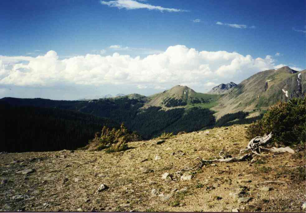
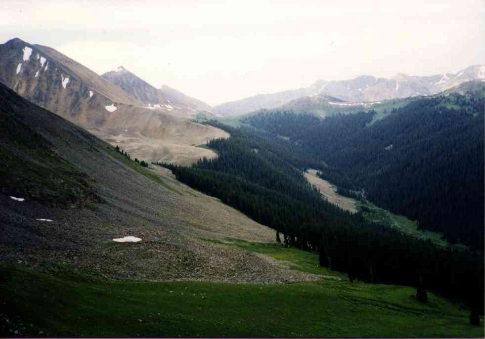
1430 Blue skies, I move along down the old 4WD road to Baker Pass. The road goes over the ridge and down to an old mica mine. Apparently the two rock outcrops here in the lush meadow were worth digging. No structures remain. I head north along the cairned trail. Skirting the rock glacier, it goes into the trees and beelines north. This territory is spectacular. Rocky peaks dropping bright rocks in waves and falls right down onto green grassy meadows. Rock glaciers. Tall peaks, deep green valleys with meandering rivers.... ahhhhhh lovely.
(Click on pictures to get enlarged images)
|
| Trail goes along treeline directly ahead. |
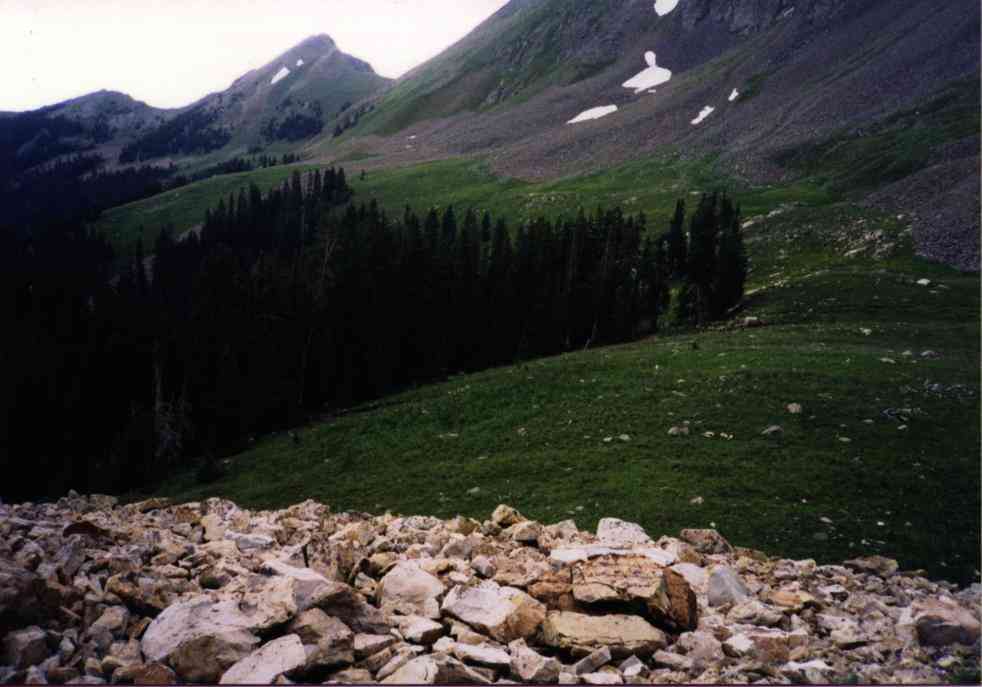
1500 I overtake a solo backpacker on the trail who had come up from RMNP via Baker Gulch. He looks wasted and is tired of being hailed on. (The climb is significant for him. He's surprised that I parked about 1 mile from there.) He is doing some sort of loop from Baker Gulch, north then return. Gotta look at the map to figure it out for myself. I leave him and go on. Briefly stop to put some moleskin on my heels then I proceed. Cross a very large talus slope.
 |
 |
| Looking at Baker pass & North. | North of the rockslide looking back South. |
1530 Nearing area for camp. The valley wall sides are timbered and steep. I dump my pack and try to find something campable. It takes an hour to determine that I've done about as well as available.
1700 Skeeters aplenty. The humidity is high, the bugs hungry, the sky overcast with storms in various directions. This depresses me somewhat. I setup camp, such as it is. I put my one-man tent across the roots of a tree - the only level ground. Fortunately the holes make decent hipholes and it's reasonably comfortable.
1820 I take a 1/2 mile hike along the trail to the north. I consider how to climb Mt. Cirrus or whether I should go to the saddle first. Undecided, I head back toward camp and have some ramen for dinner. The skeeters seem to want to die in my dinner. The first couple of days solo are always a bit difficult around dinnertime.
1920 Big storms wander the area. A large bolt seems to blast the area where my jeep is parked. Wouldn't that be the pits?
1950 Into the tent after securing everything for heavy weather. I leave the final flap open to watch the lightning on the distant ridges and write off the possibility of seeing the Perseid meteor showers.
2100 Dozing around the rumbles, dark.
2400 Finally a big blast of wind rattling the tent like someone trying to shake me out of there. Then some hail and rain.
There are 3 separate rockfalls off the ridge during the night. One lasts a very long time. Briefly I wonder if it can go far enough to get me. It doesn't - this time.
Saturday 8/3/96-
0530 Awake and lightly dozing.
0615 Out of the tent into the gray of dawn. Since I'm on the west side, it'll be gray for quite awhile. Clouds and moisture indicated in the skies. Doesn't look good.
0730 Fed, packed, and moving for the daytrip. I head north and decide to go to the saddle between Mt. Cirrus and the big 'tooth' on the ridge directly west. It's a steep, grassy rascal and takes a bunch of zigzagging to achieve.
0900 What airplane parts? None. Anywhere. But there are cairns, huge cairns down in the cirque on the far side. Can't see why. Two pretty lakes must be the ones in Bill Boyd's trip report. Well, what now? Climb Mt. Cirrus, of course.
1030 After getting tired of endless rocks, the rock size turned to chips, the summit rounds off and here's the top. Summit cairn but no register. I take pictures all around and admire the rugged view. The Never Summers really are *rotten* rock. The ridges connecting peaks are ugly jagged messes. Hiking the true Divide would be tough. The view of Lake of the Clouds in RMNP is neat. I mentally place the Nokhu Crags in position and enjoy the view.
So where're the airplane parts? I try to match the xeroxed photos to any of the ridge profiles I can see. Not this mountain, not directly north or south. Only thing close is the extension of the ridge beyond the 'tooth' and around the corner. I am deflated. That's a pretty good long ways from here. And I can't reasonably conserve elevation.
I leave the summit angling southwest toward grass slopes I know I can descend and planning to cross a circled X on the map placed there by someone who visited the site nearly 30 years ago.
That X doesn't match the photo and doesn't have any airplane parts. I trudge on. Sometimes I can scree-slide but mostly I downclimb on grass. It was a long way above the trail.
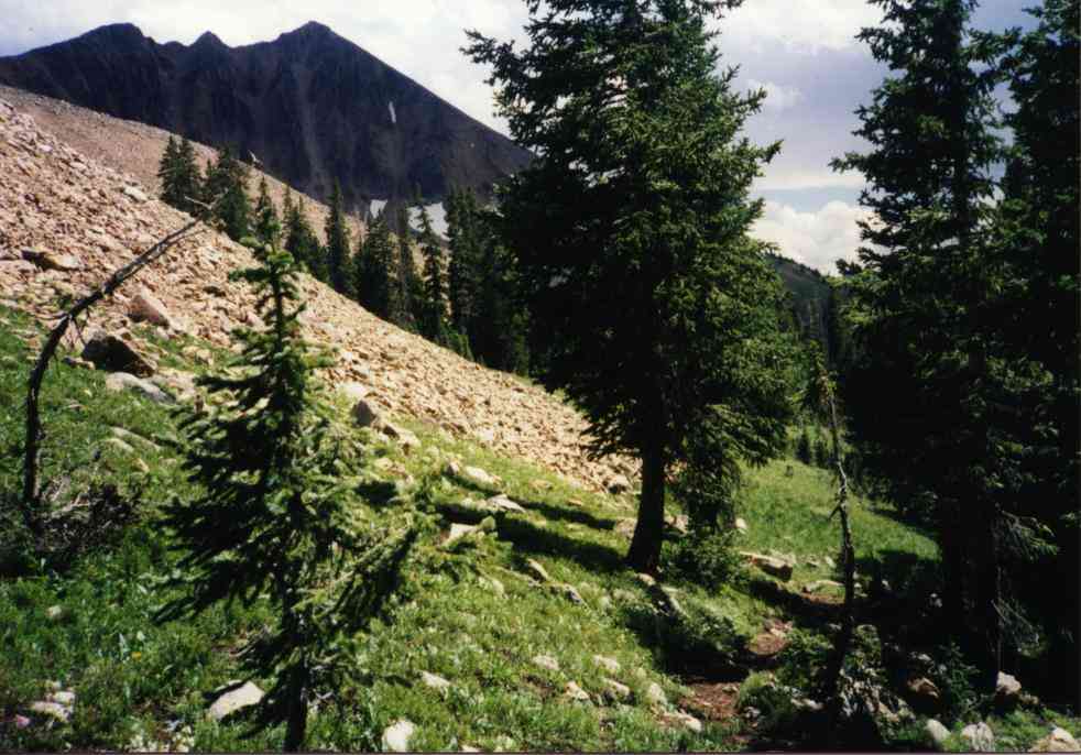
1200 I regain the trail about 300 yds from camp. Back to the north we go.
 |
| Heading north. |
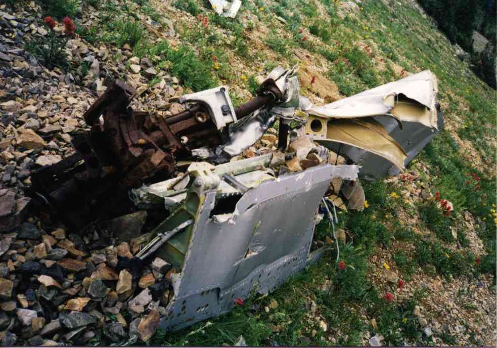
1225 I sight a chunk of aluminum all of about 15 minutes from where I'd turned around last night. I look up to the ridge. THERE! It's all over the place up there! A steep, dark rockslide decorated with shiny bits. As I get closer to the last trees at the base of the cirque, I find a whole elevator assembly standing leaning against a tree. Yup, this is the place.
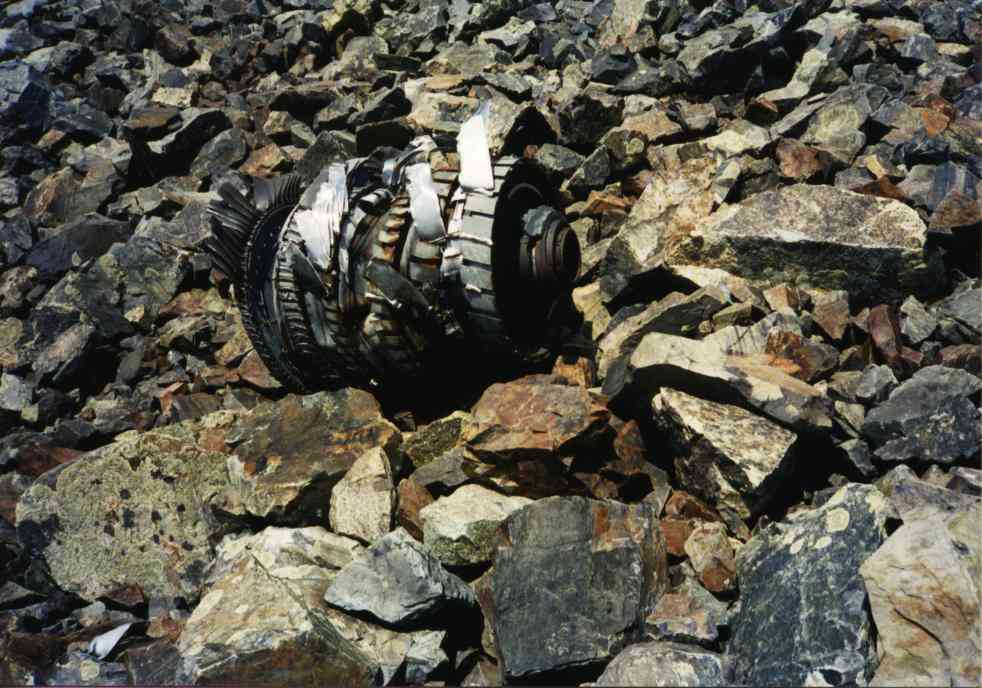
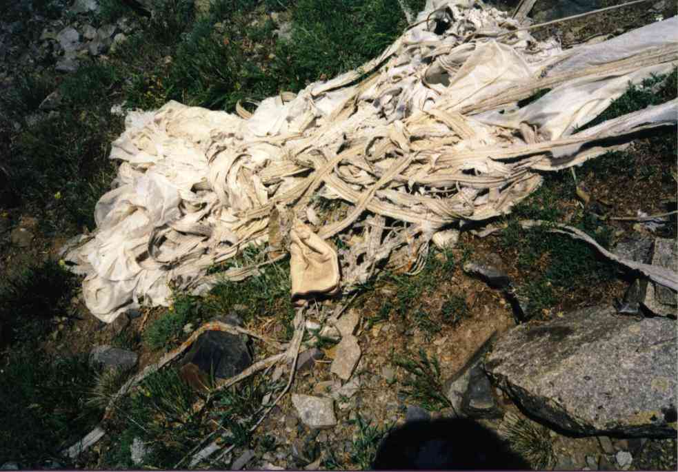
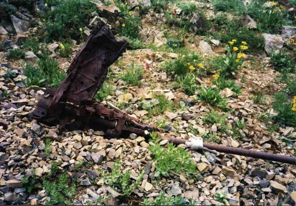
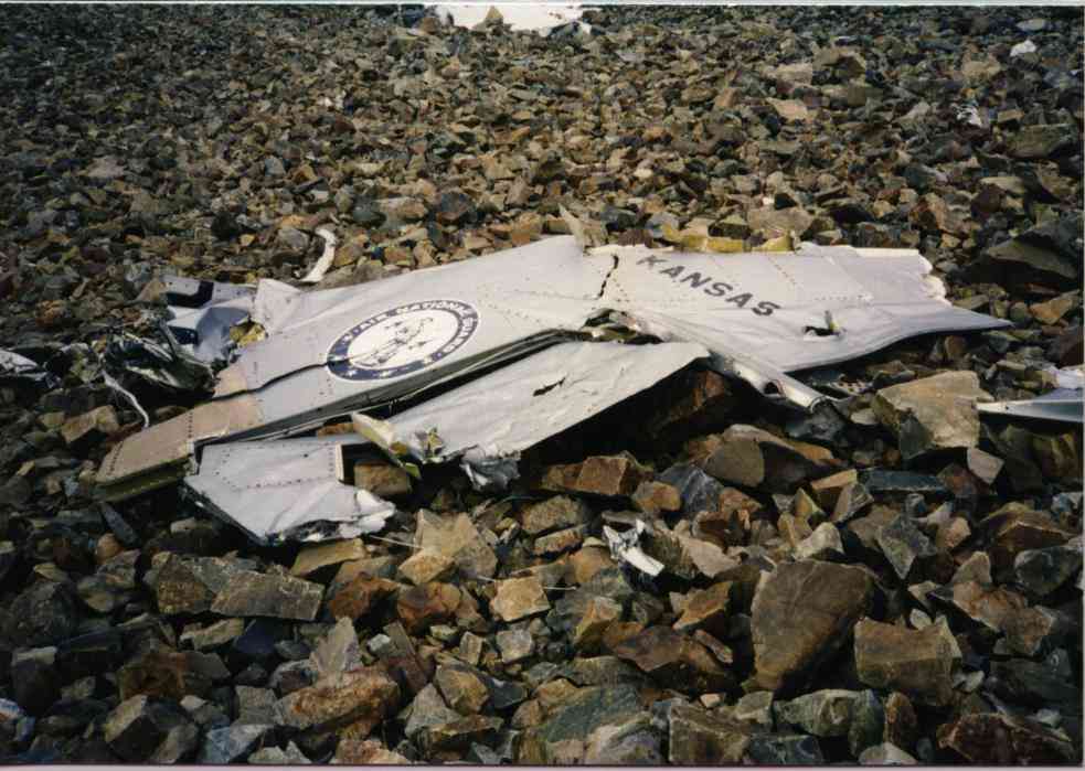
I drop my pack, take a GPS fix (13T 0422126,4476509), sling the camera and commence to exploring the site. I go from big piece to big piece taking pictures and going up the slide. The bits are all the way up to higher than I care to climb (nearly the ridge crest). I ease north and start down again. I found the 20mm gun a rusty mess with a bent barrel. I found the ammo ballast, main gear struts, nose strut, the radio, engine core, other elevator, the rudder with its Air National Guard paint intact, a 2 foot stretch of canopy rail, the radio, the airplane drogue chute (not pilot's chute), hunks of tubing, hanks of wire, a wheel with tire mounted to it, twisted scraps of hand-sized aluminum by the dozens, etc etc.
What a pretty place to crash. Lt Hart surely was vaporized instantly. I've been very fortunate today. The weather holds drier than yesterday. No significant clouds interfering or causing me to worry about maybe packing up and going home tonite.
 |
 |
 |
| Elevator standing against a tree.
My hiking stick for scale. |
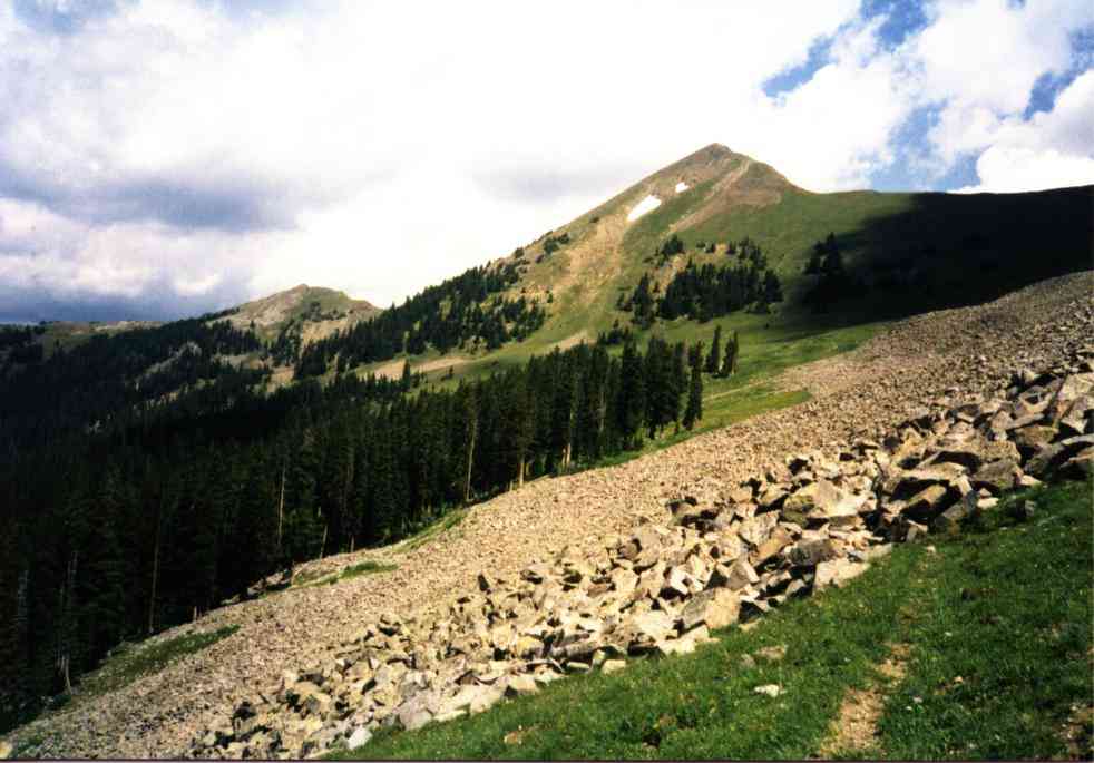
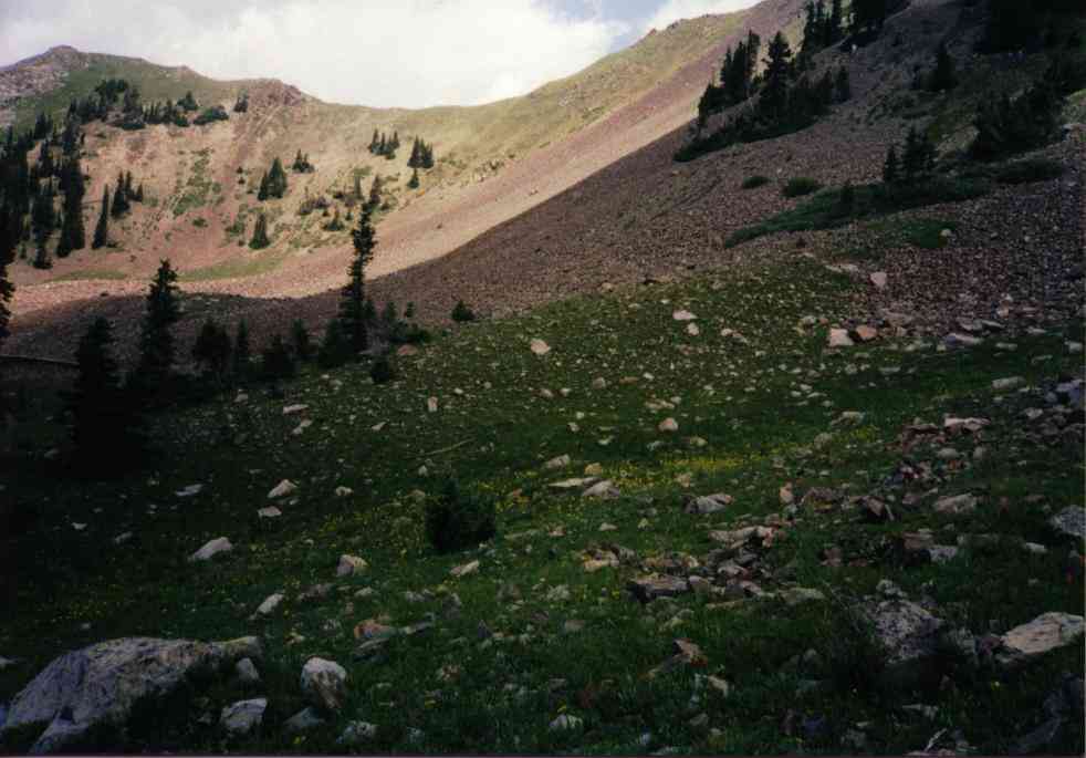
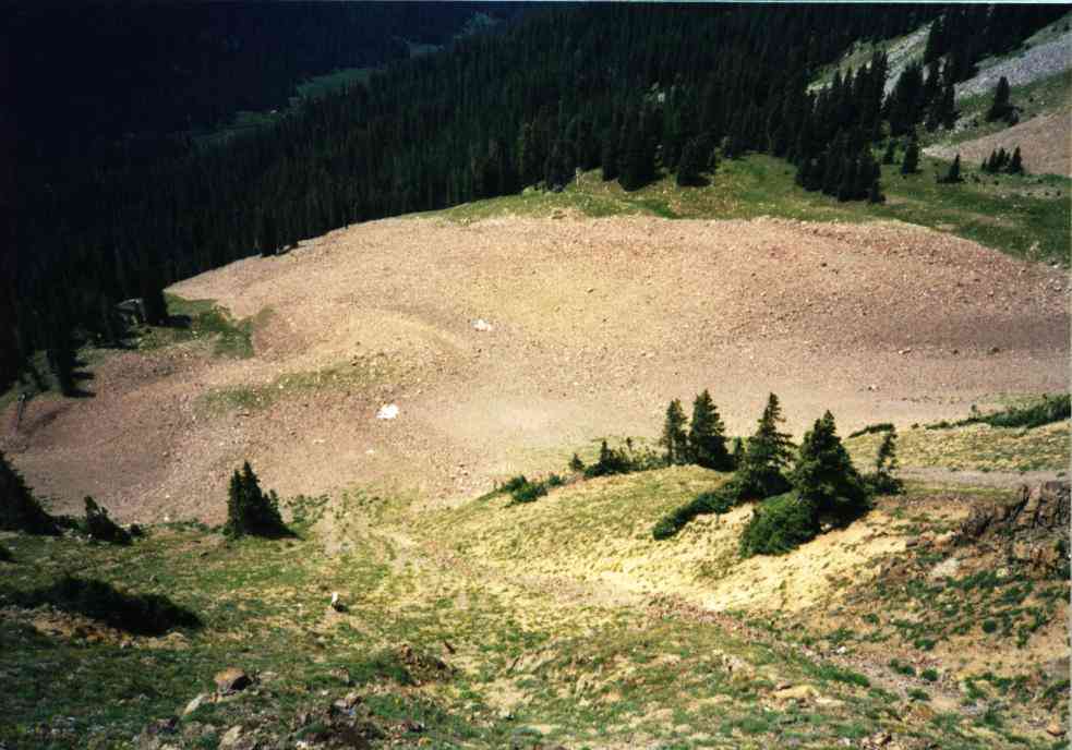
The cirque as you arrive on the site. Wreck is
up and down the center right rockslide. |
Engine core. |
 |
 |
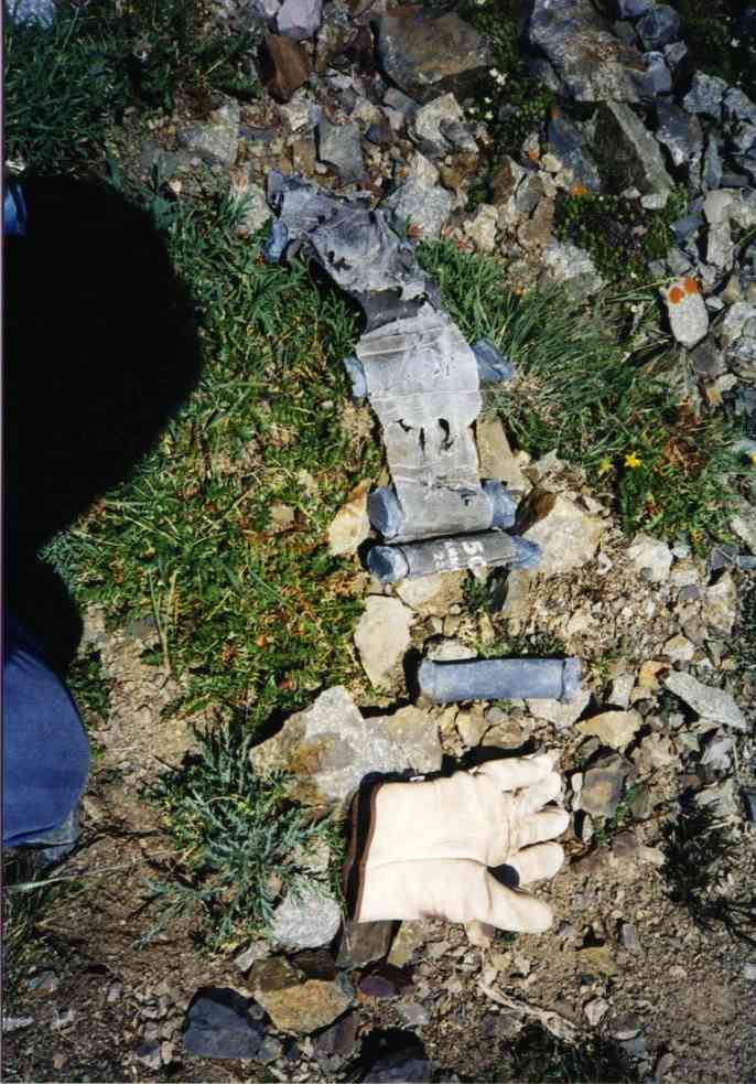 |
| Airplane's drag chute. | 1 of 4 20 mm guns | Gun ballast lead with my glove for
scale. |
 |
 |
 |
| Looking down at the cirque from impact area.
Note how steep and the S. Fork Michigan R. far below. |
Nose gear and section of fuselage. | Wheel & tire. |
1400 I head back toward camp. I feel like heading home today although I'm pretty weary from climbing Cirrus unnecessarily. Unnecessarily- not really. I said I wanted to climb it while I was in the area anyway. The views were terrific, the pictures should be good, the orientation I got from the terrain is worthwhile.
 |
 |
| Kansas Air National Guard on the rudder. | Looking from above the site to Baker Pass. |
1430 I am back at camp. A short squall blows in with hail. I cover up with the poncho, put a ground pad under my butt and sit up against a stump until it passes. I take off my boots - oboy. Big nasty blister on the R heel. Hardly felt it. I root thru my pack looking for the 2nd Skin. Can't find it. I'm SURE I packed it. I even changed the AAA battery in the mini-lite that rides with the misc emergency stuff in the baggie. But I can't find it.
I smear on some anti-biotic and make do with more moleskin. (Note- It was there, just mashed to one side. I found it at home.)
Then I pack.
1530 As I am nearing departure, two hikers emerge from the trees about 100 yds away heading uphill. They get to timberline, drop their packs and hoot and holler at the views. I quietly finish packing. Last item is to go to the creek and pump 2 qts of water for the trip. I am dry from the morning's hiking so 1 qt wouldn't do it.
I am pumping water when one of them comes over to me. I know him!!! It's Shane from work! He and his buddy came uphill from the Michigan River and are going to spend 2 more days in the area. I describe the terrain seen from Mt. Cirrus and explain my mission. They were there to hike and fish. (good fishing way down there in the river).
They talk about getting to Lake Agnes far to the north then cross-country back to the truck down in the Michigan R drainage. I shake my head at the ambition.
1600 I head out. It's not very far but there is some gain to be done from the pass to the crest between there and trailhead. I turn and look back frequently to find that I can pick out the rockslide where the plane is. It's dark rock with sparkly bits in it. I move slowly with fatigue. Thru the shady woods, to the rock glacier it's fairly level. Then from the rock glacier it's uphill to the pass. 10 steps, rest 10, 10 steps, rest 10. Man, I'm tired. While this is pretty, I'm too tired to appreciate it. 10, 10 , 10, 10, 10 , 20 , 10 (20 is too much), 10. Finally, the pass. Now there is a strong S wind blowing. Get out the fleece. Find the road/trail near the mines, follow it as it climbs. 10, 10, 10, 10. Onward. Endlessly.
I crest the hill. Downhill from here. What a view! The whole set of valleys in westerly sunshine. The crash site is crystal clearly visible as sparkly bits on a dark patch 2.5 miles away. Woof, I'm tired.
Down to the wilderness boundary sign. I drop my pack and get the camera. Several photos taken of the valley, being sure to include the sparkly slide.
Downward.
1810 There's the car. 2 vehicles at the trailhead now. A full sized 4WD pickup and an import pickup with a guy apparently cooking his dinner on a Coleman stove.
I doff the boots, change my t-shirt, swill some water, sort out some food to eat on the way home and prepare to depart.
1830 Started up and heading home.
I am fatigued to the point of the chill/sweat/shiver routine in the car. I'd forgotten to guard against that. Eat, drink, don't get out of the car or you'll go into deep shivers.
2145 Home. Safe. Shivering. Cheated death again. Mission Accomplished.
Second Trip- Approach by way of Silver Creek drainage
On a different trip, in 1997 I take my Unimog out for its maiden voyage and the first destination is the Silver Creek road which leads to an approach to this wreck from "the back side."
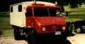
Sidebar: What the heck is a Unimog ?
My unimog has mention here because it is one of my means of transportation when wreck hunting. A Unimog is a Mercedes-Benz Four Wheel Drive Truck. Mercedes has produced many versions of this vehicle since 1955. The vast majority produced have served as cargo trucks for various European armies. During the 1990s these 30 year old trucks were being surplussed in Europe and imported to the US where gasoline is inexpensive and where there is a significant population of customers ready to buy and tinker with these fascinating vehicles. In March 1997 I bought my own truck and , with Dad’s help, fixed it up into a very reliable, if slow, 4WD camper. The Unimog will outperform my Jeep Cherokee on difficult terrain but at the price of getting only 8 mpg and having the slowest highway transit speed one can imagine.
Mogtrip 1997:
Wednesday- I set out first thing in the morning after work rush hour. Nice weather, no special traffic problems, truck is running nicely. The run up CO 14 (Poudre Canyon) is pleasant. Little traffic, enjoying the scenery and not feeling especially slow. Speed limit is about 35 mph and I am able to do approximately that more often than not.
At noon I am on top of Cameron Pass. I stop at the rest area and have a PB &J while sitting in the box.
Then I head down the hill toward Gould and the Forest Service roads to my operating area - the west side of the Never Summer mountains. I find the turnoff and go onto graded gravel then the other turnoff onto FSR 780 Silver Creek. The road isn't bad for awhile then there is a sign that says "4WD from here on." Big mudhole right behind the sign.
I maneuver thru it and go on. The trail is rocky and narrow. I fold mirrors. I startle a moose :-) I get branch-slapped thru the windows. The CB antenna on the roof takes a beating then finally folds back with a bang (the angle-setting mount moved. Don't know why the spring didn't just bend....). I remove it. I go on in 2nd. Then the engine doesn't want to run anymore. Coolant temp reads about 85C. Outside is about 75F with no wind.
I run the electric fuel pump awhile which doesn't seem to fix the problem. (Or I am too impatient with the noises the pump makes?) I'm also concerned that the electric pump has no filter and may be pumping rust flakes to the carb.....
I give it about 15 min and go on. It runs ok now. For awhile. Then I give it a rest again. I thought the fuel pump was supposed to help with this so I let it run continuously although it sounds like it's destroying itself (it has sounded that way as long as I've had the truck).
Then there is the long, rocky hill thru the woods. Tight trees, big rocks with an upslope. Mogbert just goes up the hill. Gotta watch that steering wheel wanting to spin ..... thumbs up!
After the top of the long hill there is a nice turnout so I pull off and stop. I size that spot up as a camp spot, I'm tired of the rough driving. I get out and encounter a bowhunter headed off to go quarter and retrieve his elk. He says I'm nearly to trailhead. I go on. More big mudholes and about 1/2 mile later I'm there.
I choose a flat spot to camp and park it. Whew!
I get out and look around awhile and go up the trail a bit. Nice place. Seems to only be one vehicle around a little ways off to the side.
The fellow comes down to see what I'm driving and we talk for about 30 min. Then it clouds up and starts to rain. (thunderstorm rain) I jump inside the box and seeing as how it's about dinner time, I arrange things so I can cook with my 1 burner stove sitting on a tote box with the fumes up near the roof vent. As I sit in a lawn chair and eat, I grin at the large step up in comfort this represents from trying to sleep in my Cherokee. Heck, the Cherokee wouldn't be here. I would not have brought it up the trail this far.
It seems to rain until about 0200 next morning. The sweet pitter patter of raindrops on a metal roof makes decent sleep.
Thursday morning I cook breakfast in the box like the night before then I prepare for a hike. The plan is to follow the trail into the Wilderness Area east and south up to the ridge then climb the ridge upon whose western face lies the wreckage of an F-100 Super Sabre fighter jet that crashed there in 1967. The grass is horribly sloppy wet from all the rain but I press on with wet boots and wet pant legs. The trail runs up into a really pretty elk habitat basin.
It was a very nice hike even though the map shows a trail crossing a rockslide where none exists. I should have taken the direct route but I get to the ridgetop after 2 hrs and am on the wreck shortly. I've been here before but I still take an hour to zig zag across the debris field on its steep resting place looking at the bits and pieces of the taxpayers' treasure. After looking the site over I head back to the trailhead and have lunch. Then I rig for travel and head down the trail. Ugh. The trail. It's rough and slow. Fortunately since it's downhill there is no vaporlock. By 1430 I'm on graded gravel road and have picked a campsite near a nice modest river to camp for the night.
Hart Family visits the site (next trip reports page)
Home Moggie!
Last Modified: 1/1/2008