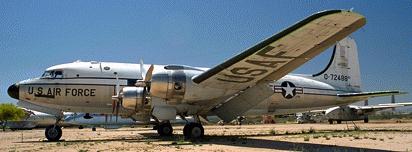
Photo by John Sepp. Courtesy of the Pima Air and Space Museum
Medicine Bow Peak DC-4
| Name | Medicine Bow Peak DC-4 |
| CAP data | 41 24N 106 20W UNKNOWN DC-6 UNK |
| GPS coords | 41 deg 20' 33.3" 106 deg 19' 23.0" |
| GPS decimal | 41.34259 106.32305 |
| UTM | 13T 0389303, 4577421 |
| Datum used | NAD 27 |
| County | Albany County |
Date: Oct 6, 1955
|
| USAF called it a C-54. Pima Museum's sample.
Photo by John Sepp. Courtesy of the Pima Air and Space Museum |

(Click on pictures to get enlarged images)
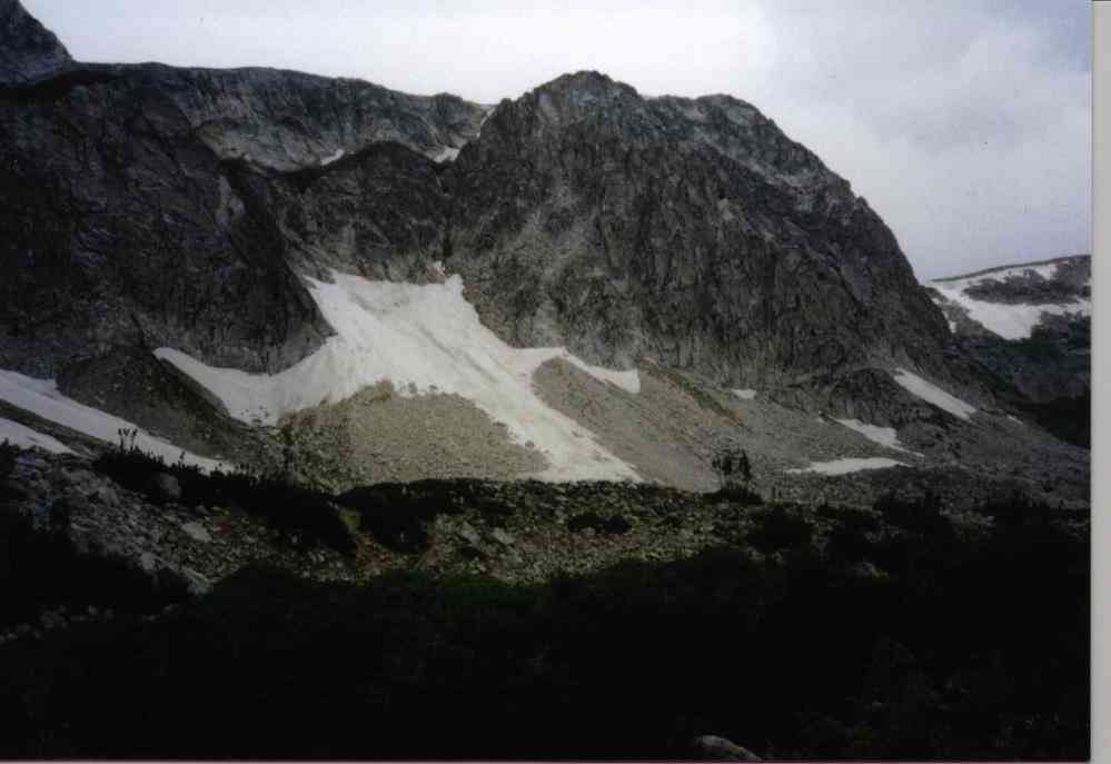 |
| Impact was above the snowfield somewhere. |
Casualties: Link to Alan Cass' extensive and detailed casualty list (on this host site)
The wreck cause: Presumed that flight was staying just beneath clouds and failed to see and avoid the face of Medicine Bow Peak. All aboard killed.
10/6/2005- I had a pleasant afternoon meeting with Mel Duncan of Laramie, Alan Cass of CU Boulder who contributed notes below, and Peter and Leslie Merrill. Peter's parents were aboard the ill-fated flight. Mel is the resident historian about this site and has unique additional insights from his 18,000 pilot hours. Mel has noted that the flight left Denver 83 minutes late and that it was common to shortcut the route. Mel also holds that the aircraft hit in a nose high (climbing) attitude and that search planes found severe downdrafts on the east side of the mountain. After the accident, black and white photos from the time show large stains on the cliff walls from the engine oil tanks and fuel hitting the near perpendicular rock. Mel also reports that later, after the investigation had concluded, UAL asked the Wyoming National Guard to use artillery to shoot down the stains and aircraft parts from the wall. They used recoilless rifles. And then napalm was used on the cliff to burn anything combustible! As of today the wreck site is now Federally protected and removal of artifacts would be a Federal felony.
11/2007- I regret to report that Mel Duncan of Cheyenne, Wyoming passed away last month. Mel was the "keeper of the flame" in terms of helping remember the victims and families of this crash. Mel organized a memorial for families in 2001 (which I was unable to attend) and planted a marker at the Miner's Cabin overlook on the Snowy Range Road at his own expense. Mel had a long and distinguished career with the Wyoming Air National Guard. Mel's obituary in the Cheyenne paper is here: http://www.wyomingnews.com/articles/2007/10/17/obituaries/04obit_10-17-07.txt
Accident report excerpts click here.
Alan Cass' extensive notes about the incident based on newspaper articles and his research.
October 5, 2005 - 50th anniversary of the tragedy.
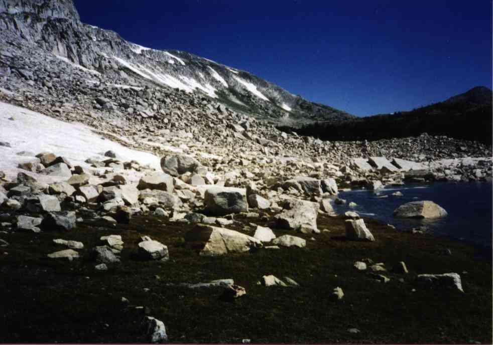
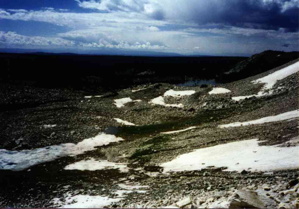
Site description: On rockslide on the south side of Medicine Bow Peak. Debris scattered from small water cascade where cliffs drain water onto snowfield all the way down to small meltwater puddle between the rock slide area and Lookout Lake. Unsure where impact point was as any wreckage would have fallen from the cliffs above and been mixed with the rockfall below.
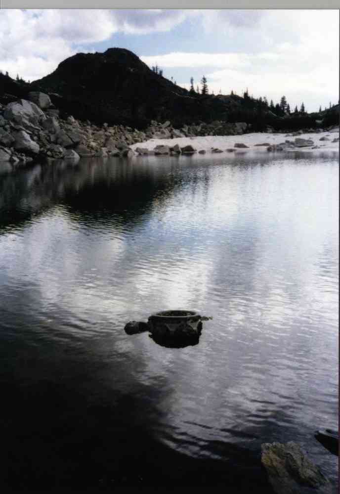
Found 2 of the 4 engines. 1 of these is in the meltwater puddle. Few other recognizable parts. (See accident report above)
Not visible from air.
Best Access: Location is visible from the Mirror Lake picnic area ( 13 0389815, 4576867 ) which is closest walking access. (Medicine Bow National Forest) Walking access is rock-hopping nightmare but the distance isn't far - perhaps less than 1/2 mile. (It costs $5 to park in the area.)
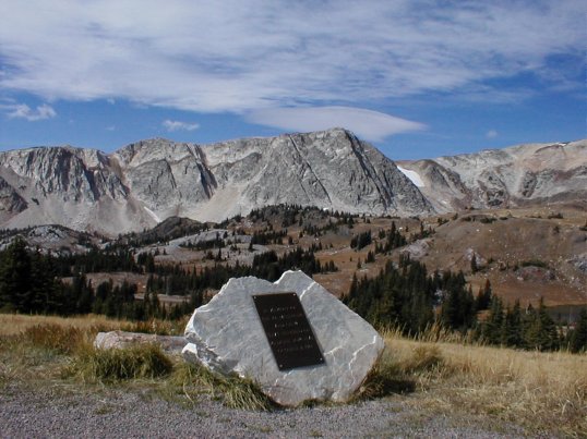
In August 2001 a stone with a bronze memorial was placed just west of the Medicine Bow Libby Flats Lookout in an area called the miners cabin turnout. This location faces the mountain where the crash occurred and is on the flight path of the aircraft. Mel Duncan of Laramie had the memorial fabricated and drilled the holes in the quartzite boulder himself.
Memorial coordinates are: 13 0390780, 4577270 (Oct. 2005)
(Click on the small image to obtain a larger version.)
 |
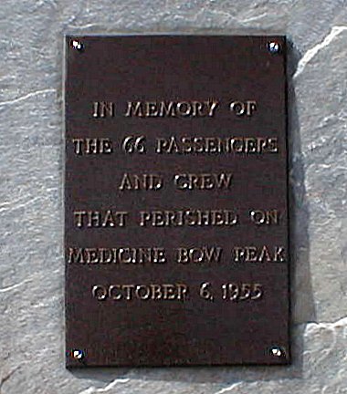 |
| Memorial view. | Memorial says: "In Memory of the 66 passengers and crew that perished on Medicine Bow Peak October 6, 1955." |
Photos:
 |
 |
 |
| Looking toward crash site. | Engine in the lake. | Engine in the snow. |
 |
| Looking back toward parking area from site. |
Home Moggie!
Last Modified: 1/1/2008