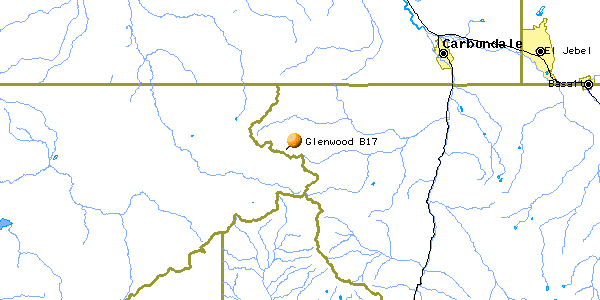
Glenwood Springs / Haystack Gate / Ski Sunlight B-17
| Name | Glenwood Springs/Haystack Gate B-17 |
| CAP data | 3919N 10731W 26OCT48,B-17,SEE*,*AF83710,13. |
| GPS coords | 39 18 01.7 N 107 25 04.8 W (see text) |
| GPS decimal | 39.30048 107.41735 |
| UTM | |
| Datum used | NAD 27 |
| County | Pitkin County CO. |
Oct 26, 1948
(Click on the picture to get an enlarged image)
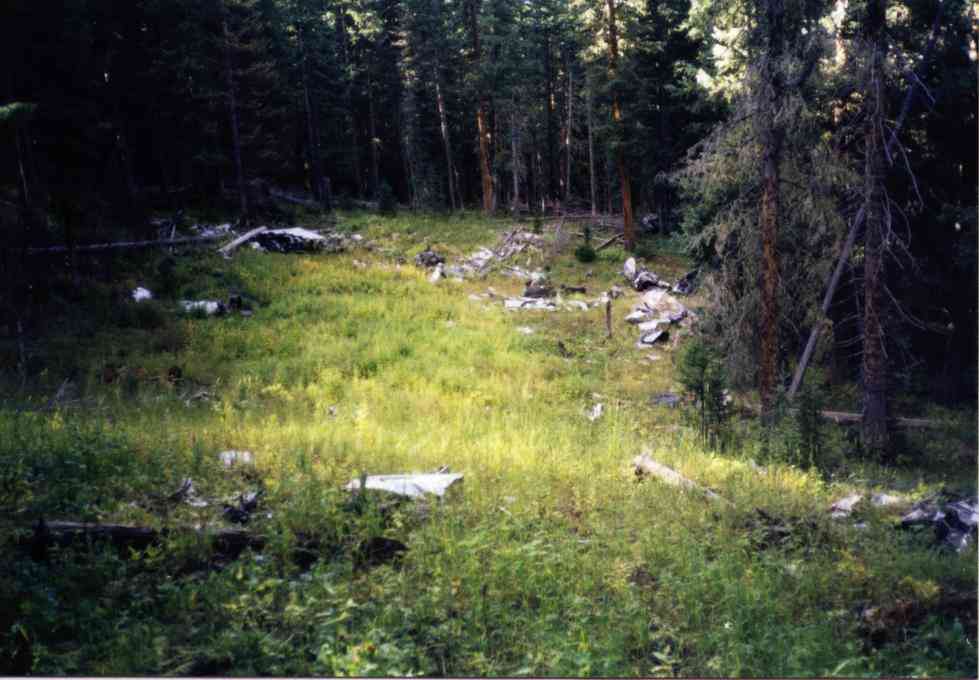 |
| General area - clearing with debris. |
The wreck cause: : Fuel exhaustion at night over mountains.
Casualties: None. Crew of 5 bailed out, all rescued.
Survivors: S/Sgt James L. Helms
Stewart L. Ackerman
S/Sgt Edward Cook
1st Lt. William H. McQuinnland
Site Description:. Aircraft crashed into woods with little apparent fire (no fuel!).. Wreck dynamited by Army as was standard "cleanup" practice for the time. Engines, gear, shredded aluminum present at site.
Road from Glenwood to Haystack Gate is automobile passable dirt.
Update 7/14/06- I am happy to report that Larry Cole emailed me that the wreck site is still there and not cleaned up. It's just that there are many openings in that woods and if you aren't using GPS you might think you are on the site when you are not.
Update 7/26/2009- Troy Rheinfrank reported trying to find the site and missing it. With a re-try he found it. He notes that the tree marking I list below which was present when I first visited the site may no longer exist. There has been tree cutting in the area. Troy reports the trailhead coordinates were right on. His coordinates for the site are: N 039 18'03.7 W 107 25'03.3 These were taken in 2009 and may be better than mine. Mine were taken when GPS signals were deliberately degraded for civilian use. Thanks Troy!
Best route Trailhead appx 39 18 17.5N 07 26 06.6 W
This is slightly back down the hill from the level meadow that I presume is the actual high point of Haystack Gate.
Turnpoint on the trail is 39 17 52.5N 107 25 14.9W (also marked by a pine tree with painted purple dot with yellow center)
Walk 029 degrees magnetic for 0.2 mi to wrecksite (all GPS info)
Trips to find the Glenwood B-17 (5 pictures)
Home Moggie!
Last Modified: 7/26/2009