Crown Point B-17
| Name | Crown Point B-17 |
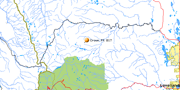
| CAP data | unk,unk,unk,403701,1054034, four-engine aircraft between Brown's Reservoir and Crown Point 4 NW Comanche Peak, intact |
| GPS coords | 40 36' 43.9" N 105 37' 57.8" W NEW, BETTER! |
| GPS decimal | 40.61219 105.63272 NEW, BETTER! |
| UTM | 13T 0446474, 4495689 NEW, BETTER! |
| Datum used | NAD 27 |
| County | Larimer |
June 13, 1944
Serial # 42-30891
(Click on the picture for an enlarged image)
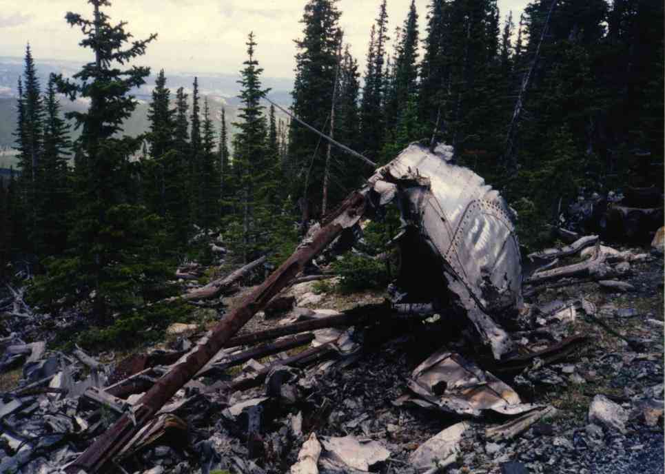 |
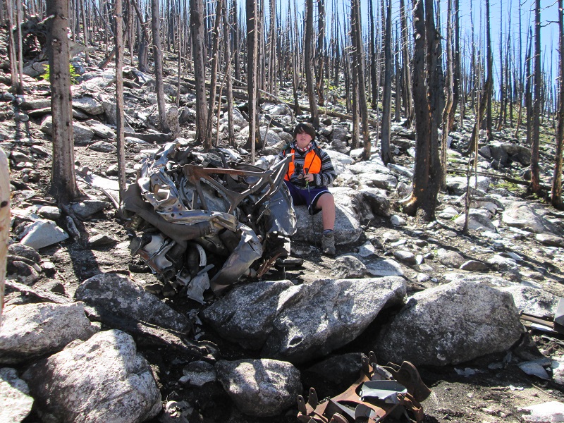
| Wreck site looking NE. |
The wreck cause: : Wrong position estimation during night navigation training flight. Flight was at 10,000’ in terrain up to over 13,000’.
Survivors: Cpl. LeRoy Faigin, Cleveland, OH
Cpl Lester Place, Corpus Christi, TX
Cpl. Max Weiner, Philadelphia, PA.
Sgt Donald E. Jacobs, Philadelphia, PA
Sgt. David Phillips, New York
2nd Lt. Harold Eisele, Rochester, NY
Casualties: 2nd Lt. Drury Holt, Columbia, S.C.
2nd Lt. Doyle J. Hall, Clinton, S.C.
Cpl. Daniel Conway, Troy, NY
FO Timothy O. Hurst, Oklahoma City, OK
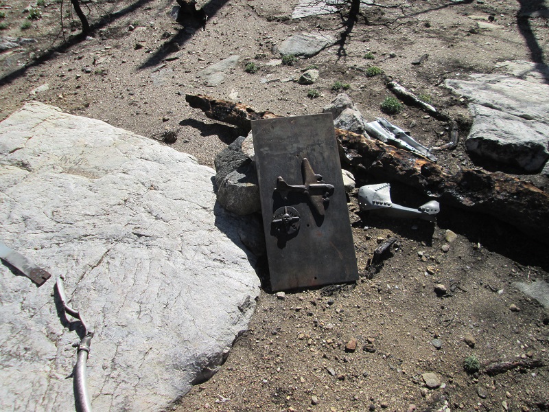
Site Description:. On a rock slope facing north on a knoll just east of the Flowers Trail. Altitude is about 10,750' This wreck was demolished by the Army with dynamite 6 weeks after the wreck. Lots of small pieces. Engines, gear, wingtips and the top turret cage survive. All-day round-trip hike. Plan for 3 hours walking each way.
Best route :There are several different ways to begin the hike to this wreck. All have their benefits and drawbacks. The simplest way is still to park at the Brown’s Lake trailhead and hike the Brown’s Lake trail until it intersects with the Flowers Trail and then hike to the saddle where the snow survey marker is present (paint is badly faded and it's real hard to see and there are several in the area)then bushwhack about 100 yards to the site. When following GPS you would find the arrow pointing perpendicular to the trail at an area that fits the description of a "saddle." That is, there is a flat spot in the trees where the land slopes upwards both east and west. If you drop downhill perhaps 100' on the trail before leaving the trail to go east, you'll find a hint of a trail to the wreck marked by cairns that traverses to the crash site and arrives at it from slightly below. I had not seen this trail before 2001.
Worst route: 7/20/2018. The Old Flowers Road runs from Jack's Gulch campground up to and past the crash site. Since the Crown Point road has been, and is, closed for beetle kill mitigation I decided to re-try this route. I'd done it in 2000 and found it ugly. I did it again on this date. And it's still ugly. After negotiating about 4 miles of easy 4WD road to get to trailhead the trek is 4.9 miles one way. The trail climbs a 400' ridge then drops down to the Beaver Creek draiinage at 9000' MSL. Then the trail climbs, often steeply, to the turnoff for the crash site at 10,800' MSL. Yes, an 1800' elevation gain. Total gain for the day is 2600'. Most discouraging is returning over the ridge to make the final 2 miles to the car. Not recommended.
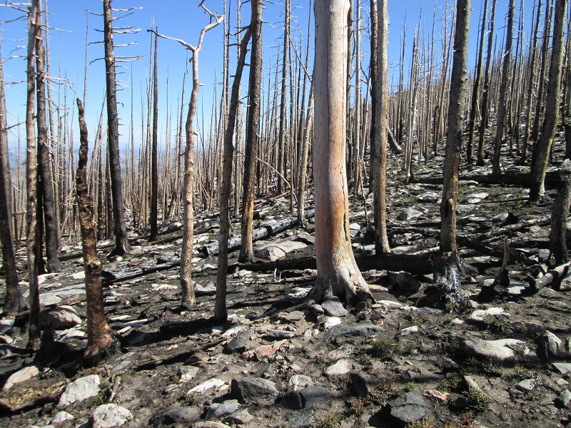
UPDATE 9/24/2022- Last summer's High Park Fire burned across the site. The fire also burned most of the pine trees on the Best Route (above) but at least spared the climb up from the Crown Point road thru the E Fork Sheep Creek drainage. Timberline trail had the pine duff burned off making footing bare rocks and ashes in many places and it's easy to lose the trail. The saddle off the Flowers Trail burned badly and the trail from there to the site mentioned above is gone.
Trips to find the Crown Point B-17 (3 pictures)
Note that the fascinating story of this wreck and its survivors are told in Troy Turner's book, COLORADO'S LOST SQUADRON listed in the references section of the front page.
Home Moggie!

Last Modified: 9/28/2022